our gulf coast is in the process of losing our wetlands at an alarming rate. places where people used to be able to ride their horses must now be reached by boat (or by swimming, if you're up to it). the rich culture of south louisiana is in danger of dying out. many efforts are being made to salvage what is left of the wetlands and to create an environment where nature can take its course and rebuild itself.
it is UNBELIEVABLE how many people in the united states have no clue what is going on down here. hurricane katrina's effects on new orleans shed some light on our problem, but very few people truly understand the real problem. me and matt went to see the "hurricane on the bayou" imax film in new orleans a few months ago and a lady next to us said "wow. i had no idea that the wetlands were so useful in protecting the cities from storms". the sad part is that she's not the only one. also.. many people who do know what is going on down here think that levees are the answer. levees aren't the only answer. there are many variables that factor into this equation. i would strongly advise everyone who reads this to further educate themselves on our situation. you will be surprised at what you find out.
here are some photos i took while i was up in the plane:
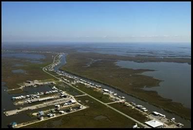
this is the fishing community of cocodrie. if you look along the left-hand side of the highway you can see LUMCON (louisiana universities marine consortium). if you are seeing this area for the first time from the air... i imagine you are surprised at how little land there really is (just as i was surprised). and for those of you who know the area, you know from experience that you really can't tell from the ground that there is that much water surrounding everything.
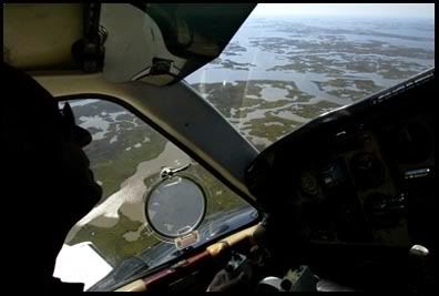
here's a view of the pilot flying over the marshes just beyond cocodrie.
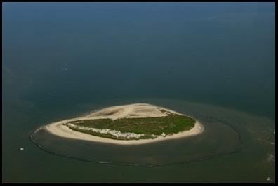
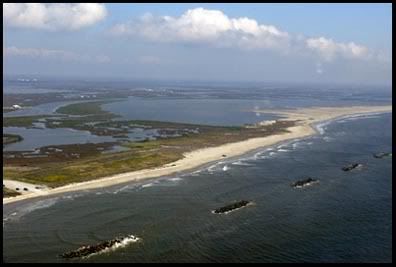
this is wine island which is a portion of the barrier island chain (notice the outline of rocks. it wasn't all that long ago that the land was out past those rocks). the chain of islands at one time was connected, but in recent years, daily erosion and hurricanes have contributed to their massive landloss. these islands are the first line of defense when it comes to storms. if the wetlands and barrier islands hadn't existed during hurricanes katrina and rita, i can't imagine how much worse the damage would have been.
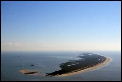
this is a photo of the west end of timbalier island, another part of the barrier island chain.
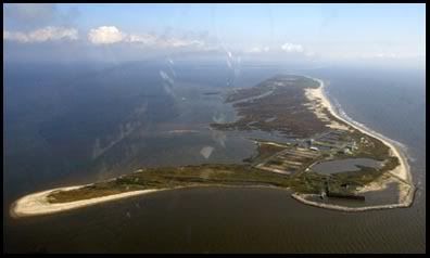
this is port fourchon. the rock jetties off the coast are to help prevent coastal erosion.
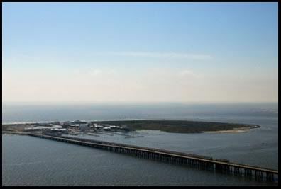
this is the grand isle bridge... as you can see, there isn't much land here.
this is a photo of fort livingston on grand terre island which you can see from the tip of grand isle (a louisiana state park). barataria pass separates the two.
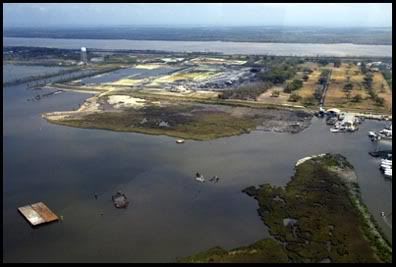
and here is a shot of port sulphur in plaquemines parish. when flying over port sulphur, if you looked close enough, you could see the superdome. it was actually kind of neat. i bet not many people realize that just outside of new orleans is marshland. but it's true.

and of course.... a self portrait.
hope you enjoyed the photos and maybe even learned a thing or two. you can click here to check out my wetlands myspace page (it's got a plethera of links and more photos)... if that doesn't work... or if you'd like to check it frequently, i have a very convenient link off in the right hand column of my blog.. along with all the other awesome links you should check out.
also, if you haven't seen matt's aerial slideshow of lower terrebonne parish from when we went up in a helicopter last july, click here. he's also got a few other galleries including a "hurricane rita: then/now" gallery that you might check out. just click here. (when you get a minute, you really should check those out... he's got some... eh... eh.... alright... he's got some great stuff so go check it out)
alright. well, peace, love, and jelly donuts.
goodnight all :o)


2 comments:
Good stuff, Thanks!
very nice! Like the info and photos
Post a Comment